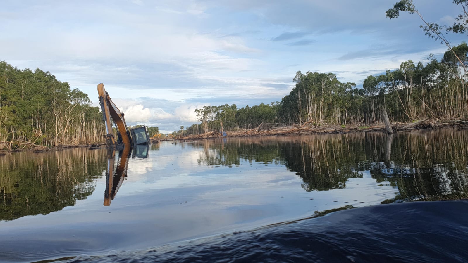
 Excavators bulldozing Melaleuca forests to build a new food estate road in Merauke. The image shows heavy machinery partially submerged in a waterlogged area, surrounded by fallen trees. Photo taken by Yayasan Pusaka Bentala Rakyat
 Indonesia’s Race for Rice: A Gamble in Merauke’s Wetlands
Excavators bulldozing Melaleuca forests to build a new food estate road in Merauke. The image shows heavy machinery partially submerged in a waterlogged area, surrounded by fallen trees. Photo taken by Yayasan Pusaka Bentala Rakyat Across Indonesia, vast rice fields are disappearing — particularly in Java and Bali, where urban expansion, industrial developments, and infrastructure projects are replacing agricultural land.
As a nation reliant on rice as a staple food, this loss raises a critical question: how will Indonesia feed its population in the future?
The government’s answer is ambitious: a one-million-hectare rice project in remote Merauke Regency, in southern Papua, led by a military task force.
In August 2024, several hundred excavators arrived in Wanam and Wogikel, two villages at the heart of the project. Infrastructure plans include a logistics seaport and a 135 km Food Estate Road extending eastwards across Merauke, the southeasternmost regency of Indonesia.
Our analysis of ultra-high-resolution (50 cm) satellite imagery from Skysat/Planet, commissioned by the NGO Mighty Earth, confirms the rapid land clearing for this new port and road development.
As of December 12, 2024, 4,200 hectares—mostly Melaleuca swamp forests—have been bulldozed, and drainage canals are under construction to drain the swamps.
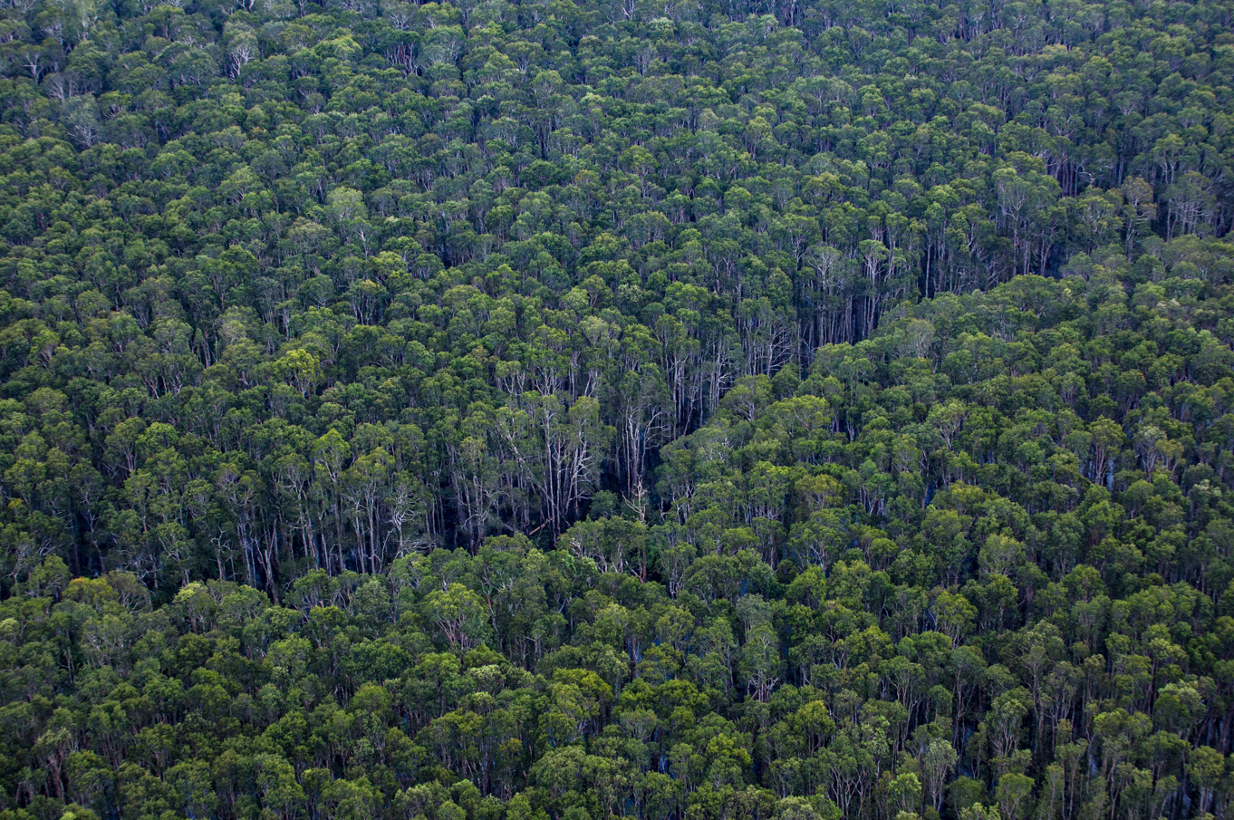
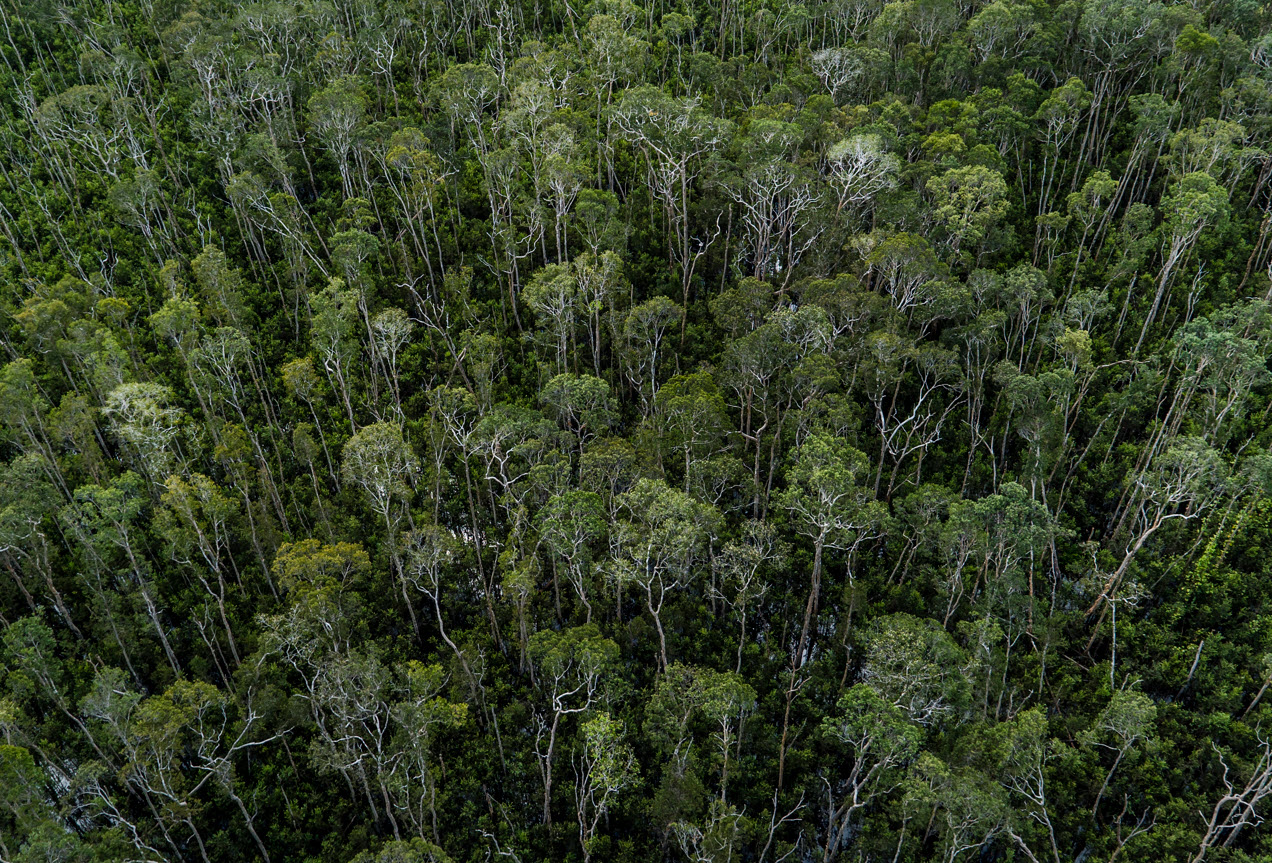
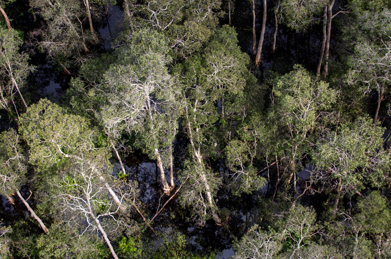
The southern part of Merauke is a remote wetland wilderness, a mosaic of dense evergreen rainforests on drier hills, interspersed with expansive savanna grasslands, woodlands, and Melaleuca forests. This vast and rugged landscape remains largely untouched, home to Indigenous peoples who continue to uphold their ancestral ways of life and maintain deep cultural connections to the land.
Also called paperbark trees, Melaleuca trees thrive in these seasonally flooded swamps with nutrient-poor soils. They act as natural buffers against extreme floods. Despite their sparse appearance, these forests shelter diverse wildlife — birds, amphibians, and reptiles that thrive in wetlands. They sequester carbon, and Merauke’s Indigenous peoples depend on Melaleuca forests for their livelihoods.
However, Melaleuca forests are often overlooked because, unlike dense rainforests, they are less diverse and have more open structures. These characteristics are sometimes mistaken for signs of degradation, leading to misconceptions that Melaleuca forests are degraded ecosystems, which are not worthy of conservation.
The construction of the new 135 km Food Estate Road will further threaten these ecosystems by increasing deforestation, putting more forested areas, including Melaleuca forests, at risk.
Setting aside the environmental and social concerns of such a project, a critical question is whether it makes sense to try to grow rice in Merauke’s swamps.
Merauke Regency has a tropical wet and dry savanna climate (Köppen classification: Aw), marked by extended wet and dry seasons, making precise irrigation systems essential for successful rice cultivation.

Merauke, Papua Climate Graph courtesy of Climate.Top
Wildfires naturally occur each year during the prolonged dry season, with increased intensity during El Niño years. Draining the wetlands could exacerbate the frequency and scale of these fires. Without waterlogged soils to suppress ignition, flames could spread rapidly across the landscape—and if peat is present, the risk of uncontrollable fires would be significantly higher.
Moreover, the soil conditions of Melaleuca wetlands may pose additional challenges. These soils have high acidity — conditions far from ideal for rice cultivation. If peat soils are present, rice farming will be even more difficult, as their high acidity and low fertility create a harsh environment for crops. Without careful management and suitable soil amendments, rice farming in these wetlands will likely face significant obstacles.
This new rice project scenario echoes Indonesia’s previous attempt at a million-hectare rice project. In the 1990s, under Suharto’s New Order regime, the government bulldozed and drained vast peat-swamp forests in Central Kalimantan for rice farming. The project failed.
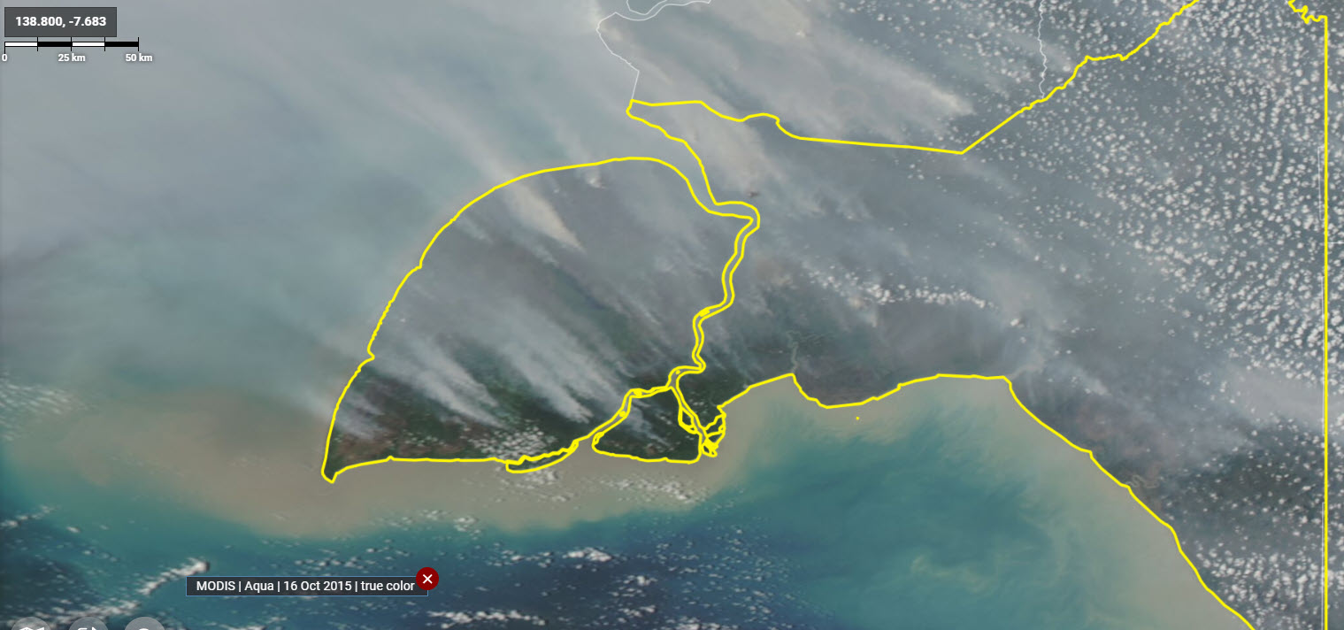
Large-scale deforestation, drained peatlands, and failed rice yields left the region degraded and vulnerable to seasonal floods and persistent wildfires. These fires, which intensify during strong El Niño events or Positive Indian Ocean Dipoles (such as in 2015 and 2019) blanket the region in toxic smoke for weeks, causing widespread illness and economic disruptions across Southeast Asia. Much of the land, once lush rainforest, is now unproductive, dominated by fire-tolerant scrublands and invasive ferns.
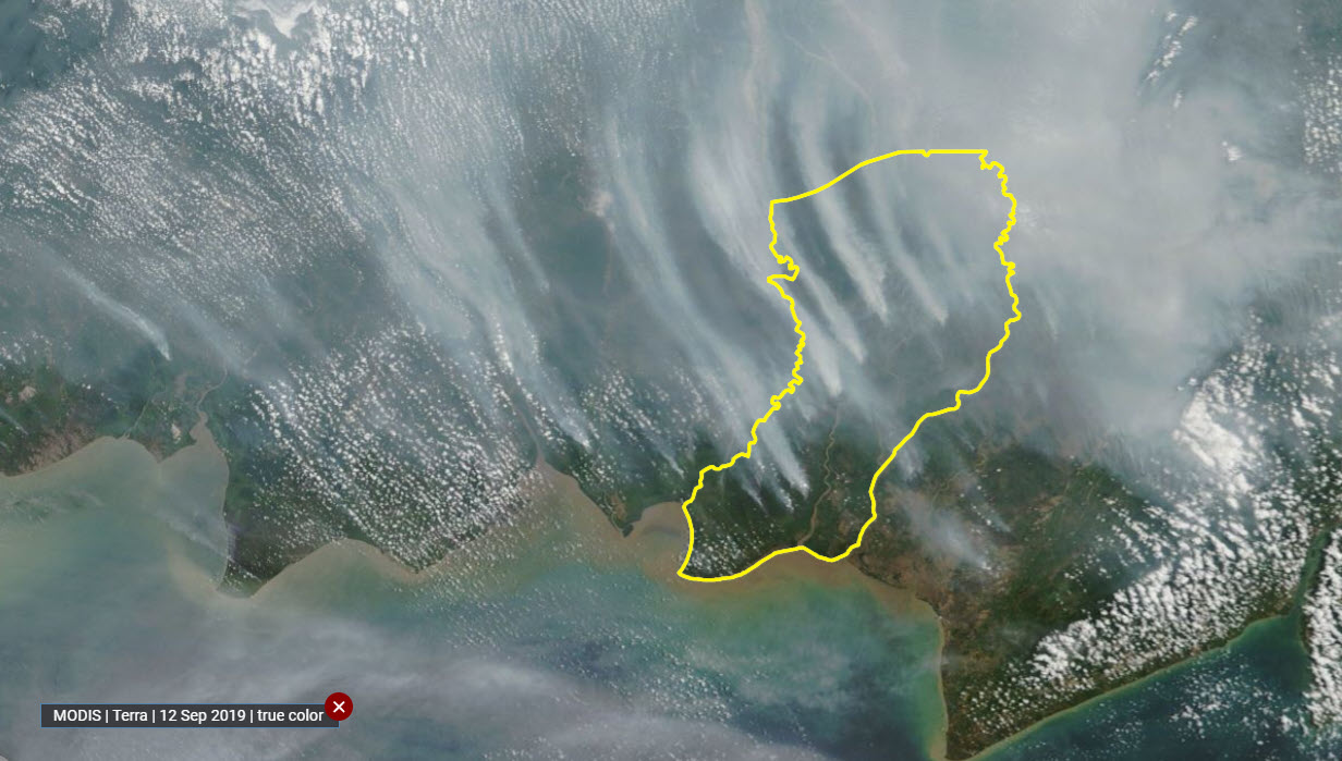
IOD+-driven dry season, captured by MODIS on September 12, 2019. Thick plumes of smoke billow from multiple ignition points, drifting across the landscape and into the atmosphere, highlighting the region’s heightened fire risk during prolonged drought conditions. Image generated in Nusantara Atlas.
The parallels between Central Kalimantan’s failed mega rice project and Merauke’s new rice initiative are striking: both involve large-scale deforestation, wetland drainage, and ambitious government-led programs.
As bulldozers continue clearing Merauke’s Melaleuca forests, the question lingers: will this new attempt meet the same fate?
___________
To showcase the rich diversity of this remote region, we geotagged photos on Nusantara Atlas taken from a helicopter by photojournalist Ulet Ifansasti for Greenpeace during the Rainbow Warrior’s 2018 Southeast Asia tour in Merauke.
These images capture the region’s diverse landscapes, highlighting an array of vegetation ecosystems, including dense tropical rainforests, melaleuca forests, savanna woodlands, grasslands, and mangrove ecosystems.