From Rice Fields to Beach Clubs, and Sprawling Cities: 60 years of Change in Southern Bali
Before Bali became a global tourism hotspot, its southern landscapes were dominated by paddy fields, coconut groves, and tranquil coastlines.
This peaceful island began a dramatic transformation in the 1970s, following the inauguration of the international airport in 1968. Within a few decades, Bali evolved into one of Asia’s most visited destinations, reshaping its landscapes and way of life.
The rapid pace of change is undeniable. Anyone who has visited Bali more than once can attest to it.
While Bali’s transformation is well known, the details of how and where this transformation occurred have remained undocumented — until now.
Unveiling the Past Through Satellite Images
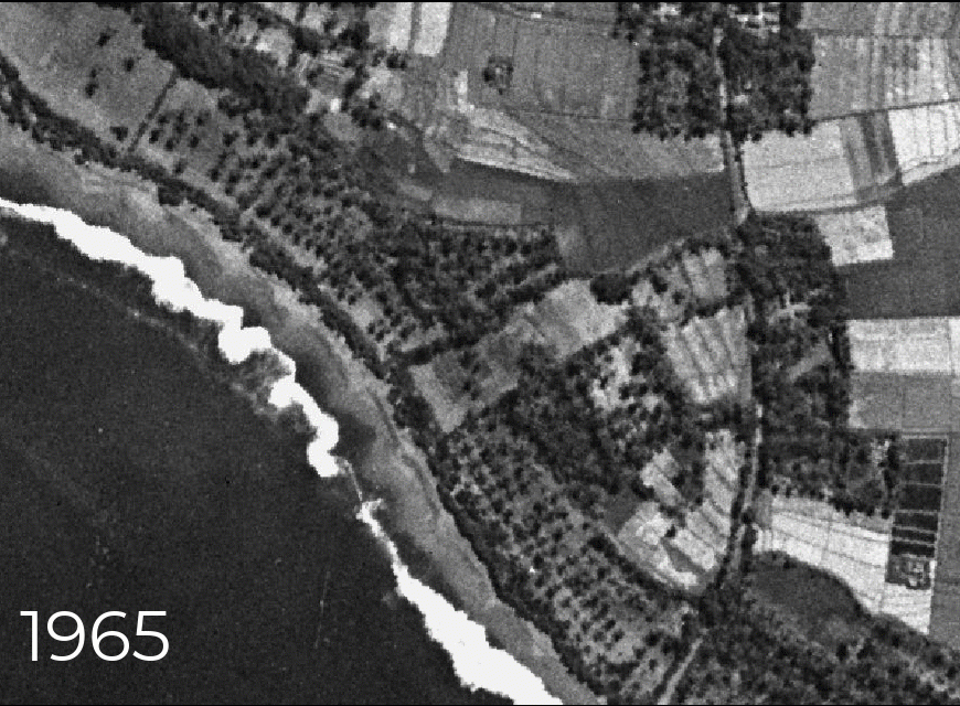
For the first time, The TreeMap has unlocked a hidden chapter of South Bali’s history. Declassified, ultra-high-resolution satellite images from 1965—never before seen by the public—are now available on Nusantara Atlas, offering an unprecedented look at the island’s southern landscape before the tourism boom reshaped it.
Captured by the once-secret KH-7 Gambit satellite, a Cold War-era U.S. reconnaissance mission, this monochrome image boast a stunning ground resolution of 0.61–0.91 meters—allowing us to zoom in with incredible detail on Bali as it was six decades ago. Now, anyone can explore this historical imagery interactively on Nusantara Atlas using a desktop, laptop, or mobile device.
Simply enter your Bali address or zoom in (up to a 1:1000 scale) and use the time slider to witness 60 years of dramatic transformation.
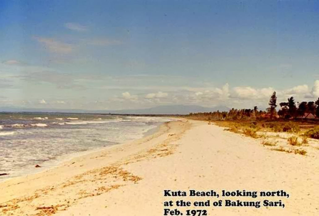
Kuta beach
A forthcoming analysis will quantify the scale of development—measuring how resorts, beach clubs, villas, and urban sprawl have reshaped the landscape. This work will provide deeper insights into the environmental, agricultural, and cultural shifts that have unfolded over the decades, helping to document Bali’s past while informing its future.