FSC-certified South Korean company pulping natural forest in Papua to produce eco-friendly paper
A new investigation by a coalition of Indonesian, South Korean and international NGOs details the devastation of pristine forests in the remote province of Papua, Indonesia.
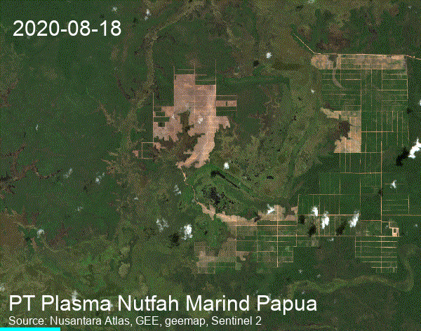
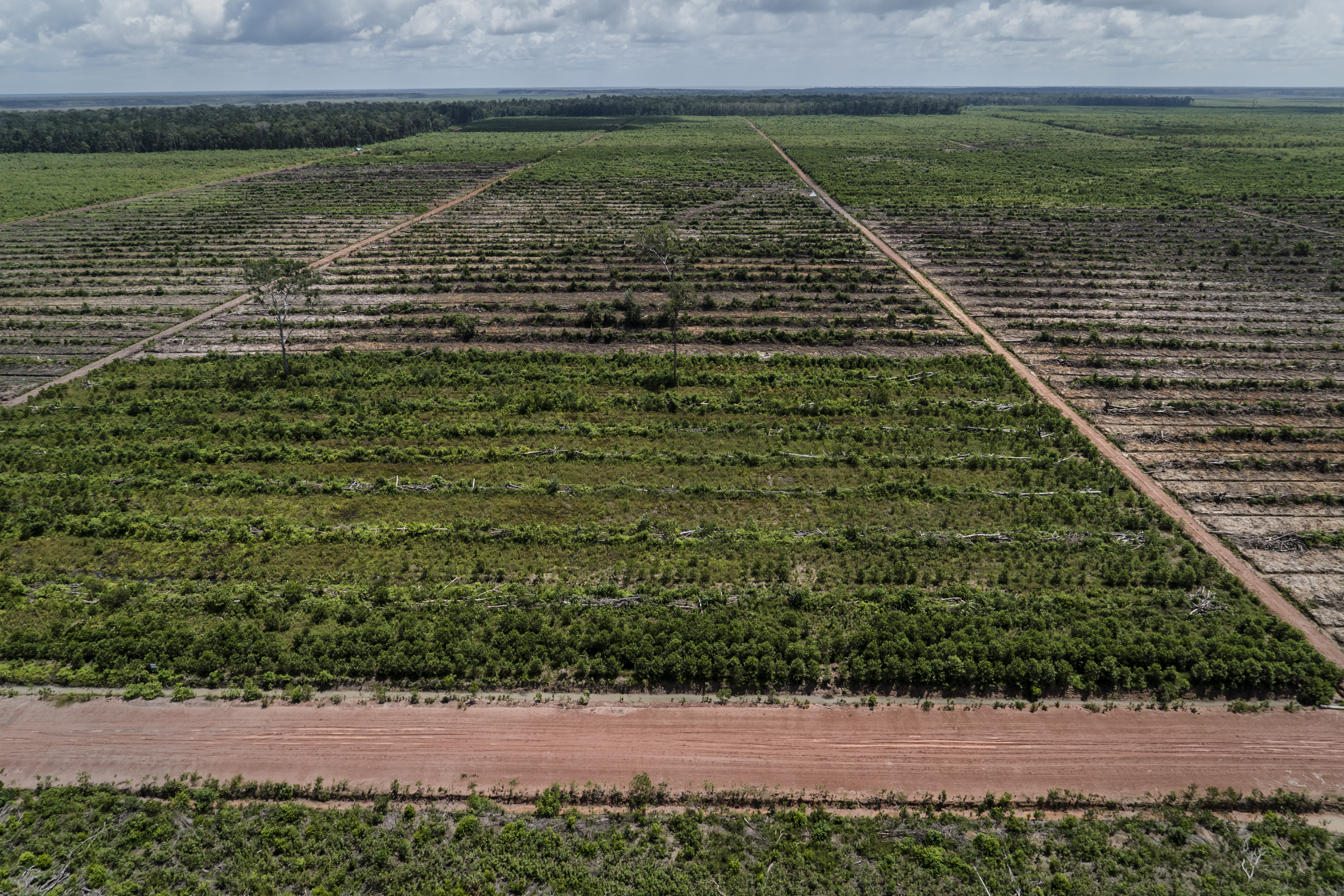
Moorim is a Korean company certified by the Forest Stewardship Council (FSC). Its Indonesian subsidiary PT Plasma Nuftah Marind Papua (PT PNMP) clears natural forests and Indigenous lands to develop monoculture Acacia and Eucalyptus plantations in the district of Merauke. FSC is a global forest certification system established to promote sustainable forest management. It prohibits the conversion of natural forests and violations of Indigenous Peoples.
Indigenous Peoples strongly oppose the development of Acacia plantation in the area managed by PT PNM because the land overlaps with the ancestral lands of the Marind People.
Using Sentinel-2 satellite imagery, we estimate PT PNMP cleared 1718 hectares of primary forest from Aug. 18 2020, to Mar. 01 2022. More than 6,000 hectares have been converted since 2015. With 64,000 hectares (including 17,000 ha of forest) of the area under the management of PT PNMP, more forests are at risk.
The coalition urges the (FSC) to launch a full investigation of this matter to maintain the integrity of the FSC certification.
Coalition: Environmental Paper Network (EPN), Mighty Earth, Pusaka, Solutions for Our Climate (SFOC), Korean Federation for Environmental Movement (KFEM) and Advocates for Public Interest Law (APIL))