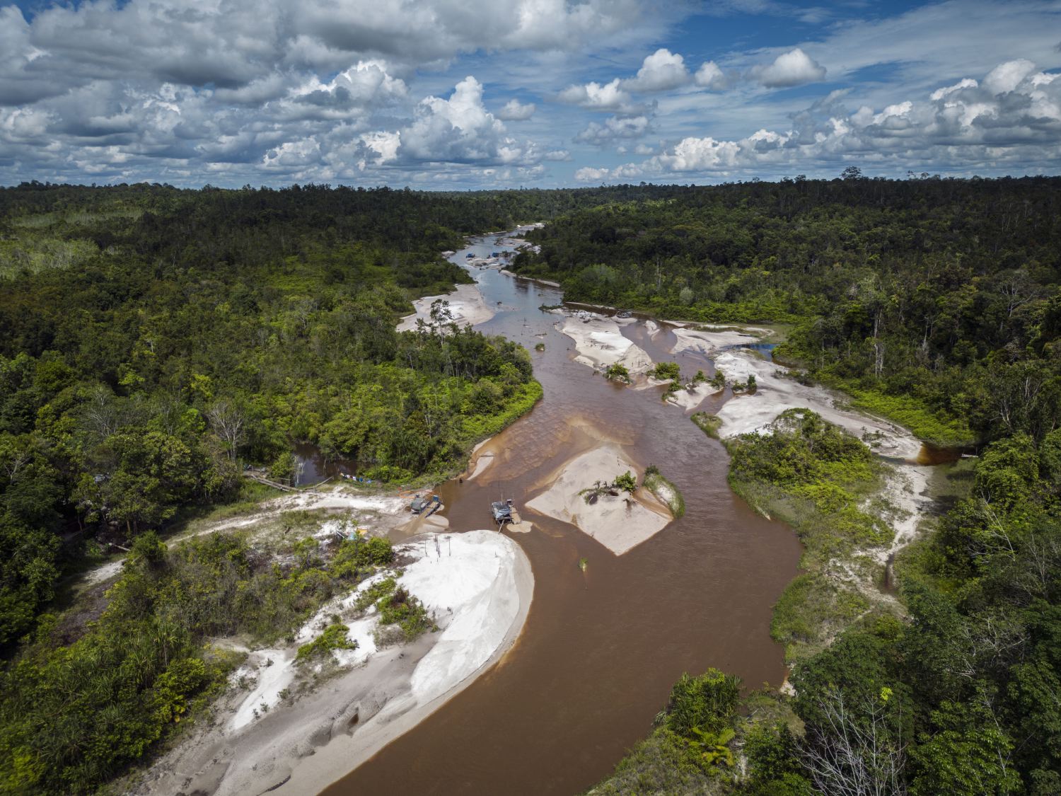
 Artisanal gold mining along river banks of Kahayan river, Central Kalimantan.
 Indonesia’s Mining Crossroads: New Map Unveils Opportunities for Environmental Monitoring
Artisanal gold mining along river banks of Kahayan river, Central Kalimantan. David Gaveau and Douglas Sheil wrote this article
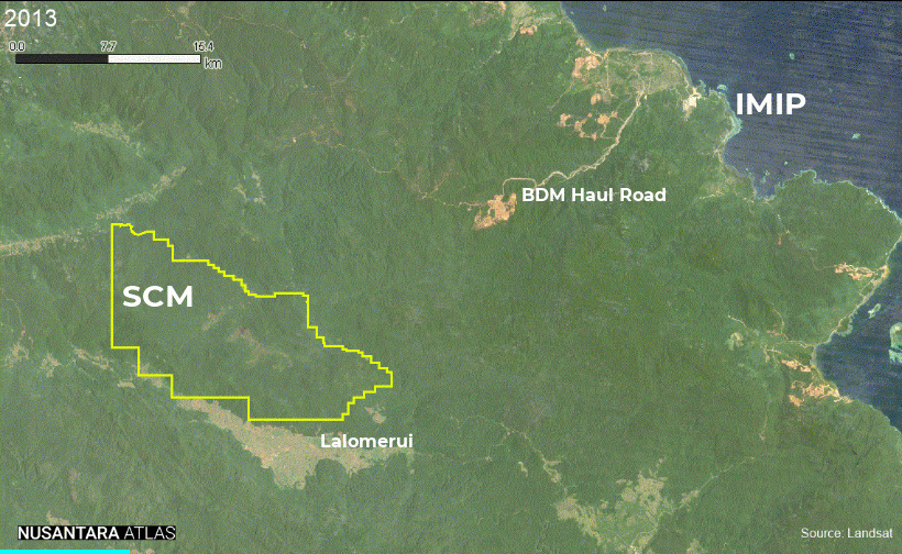
- The TreeMap created the first 10-meter resolution map of Indonesia’s mining land footprint, highlighting open mining pits and infrastructures.
- Since 2001, 721,000 hectares, including 150,000 hectares of primary forest, have been transformed into mining infrastructures by December 2023.
- Coal mining had the largest impact, covering 322,000 hectares, followed by gold (149,000 ha), tin (87,000 ha), and nickel mining (56,000 ha).
- Annual mining-driven deforestation averaged 6,500 hectares, peaking at 10,000 hectares per year by 2023, nearly tripling early 2000s losses.
Jakarta – Indonesia’s vast mineral wealth, including gold, copper and various rare metals, has fuelled a major mining boom. Nickel, needed for the lightweight batteries used in electric vehicles, and coal, essential for powering industries, have had especially rapid growth.
This boom brings economic developments and related progress. However, there is a price for the environment. Forests are being cleared, habitats degraded, and the nation’s famously rich ecosystems are suffering.
Deforestation and related habitat loss due to mining and its associated developments contribute to carbon emissions, disrupt ecosystems and threaten many critically endangered species. Large-scale mining often displaces local communities and disrupts their ways of life.
A case in point is the Hongana Manyawa, one of the last nomadic hunter-gatherer tribes in Indonesia, who are impacted by the encroachment of mining operations into their ancestral lands on Halmahera island in Eastern Indonesia.
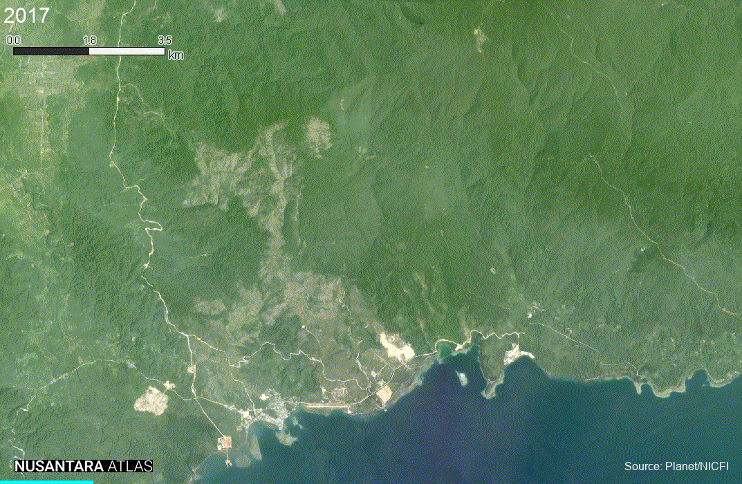
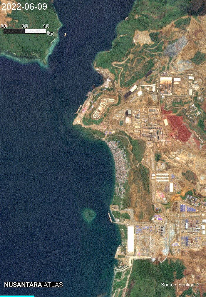
Nickel mining in Weda Bay, Halmahera, has significantly affected the environment and local communities, including indigenous forest-dwelling tribes and coastal fishing communities. The Hongana Manyawa, one of the last nomadic hunter-gatherer tribes in Indonesia, are deeply affected by the encroachment of mining operations into their ancestral lands. Click here for location.
Mining operations also contaminate vital water sources for local communities and disrupt fisheries, affecting livelihoods. On Obi Island, Eastern Indonesia nickel mining regularly turns coastal waters red contaminated by high levels of heavy metals.
Mapping mining from space
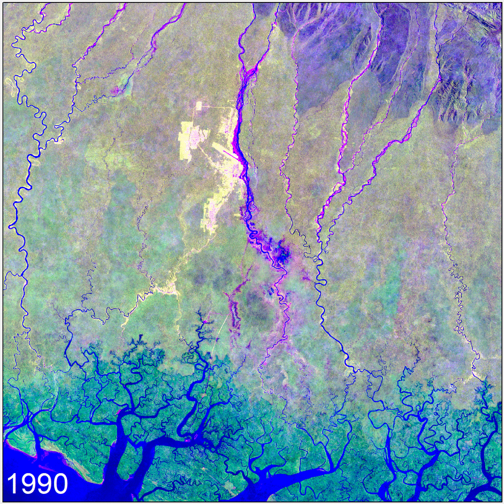
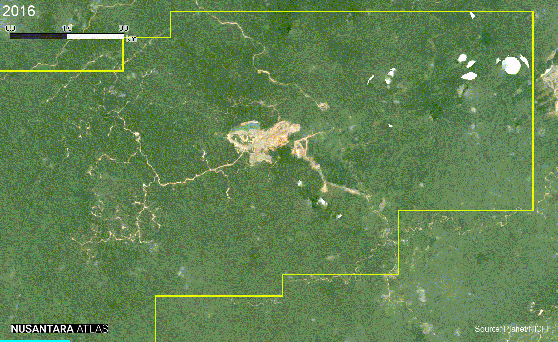
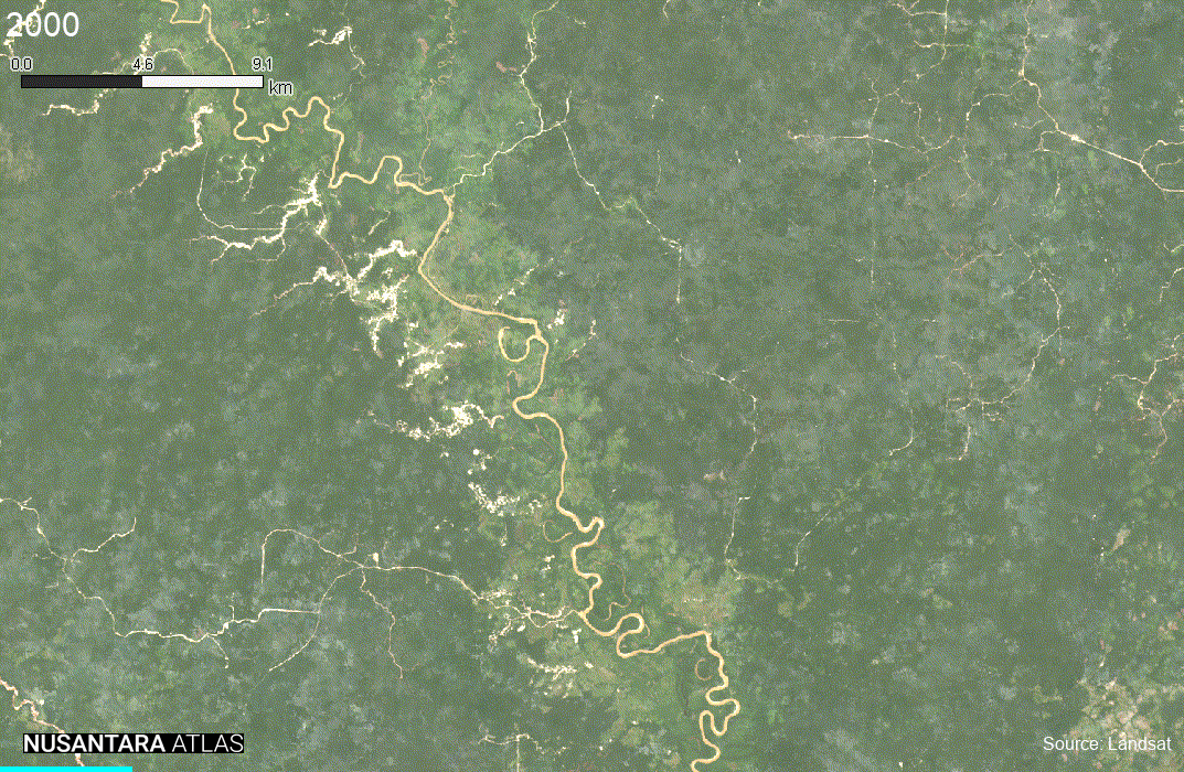
To monitor Indonesia’s mining sector, we developed a “mining” map using high-resolution satellite imagery from Sentinel-2 and Planet/NICFI and two decades of historical Landsat images.
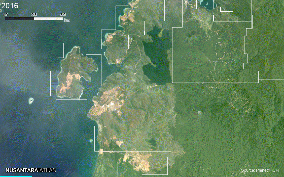
This map provides the first 10-meter spatial resolution depiction of Indonesia’s mining land footprint as of December 2023, indicating the locations of mines across the archipelago.
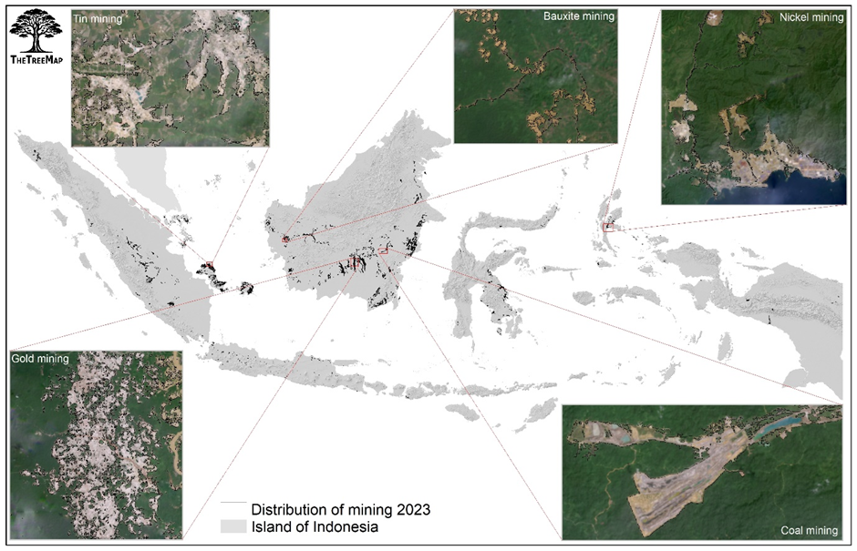
Indonesia’s mining land footprint map delineates the total areas transformed into mining infrastructures since 2001, with the last date for this analysis being December 2023. This map includes old and recent Mining Pits, where raw materials are extracted. It also highlights Processing Facilities, showing the locations and sizes of factories that transform raw materials into refined products. The map details Mine Tailings areas, indicating where these materials accumulate, their impacts on land cover, and their proximity to vulnerable habitats. Additionally, it identifies Mining Roads that connect mining sites to processing facilities and other infrastructure, highlighting their role in facilitating the movement of mined materials and equipment.
To assess the impact of Indonesia’s mining sector on primary forests*, we integrated Indonesia’s mining land footprint with a forest mask that shows the extent of primary forests in 2000, as provided by the Nusantara Atlas. We determined the years in which forests were cleared by analysing a dense historical time series of Landsat images, identifying the year the forest transitioned to mining.
From gold mining impacting orangutan habitats to sand extraction in Bangka Belitung crucial for mobile phones, the map highlights the environmental toll of these activities. The mining land footprint map is accessible for viewing interactively through our deforestation monitoring service Nusantara Atlas.
Explore Indonesia’s mining land footprint map in Nusantara Atlas
Mining-driven Deforestation
How much deforestation in Indonesia has already been caused by mining?
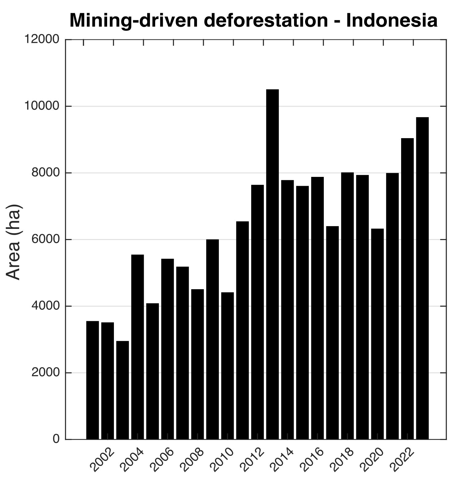
Our analysis reveals that since 2000, mining has cleared an estimated total of 721,000 hectares, including the loss of 150,000 hectares of primary forest* by December 2023. This is considerably less than the deforestation attributed to the expansion of palm oil and wood pulp plantations, which have converted 3 million hectares and 1 million hectares of primary forest respectively. Nonetheless, our data show that deforestation associated with mines has been increasing, occurring in previously untouched areas in remote islands of eastern Indonesia.
On average, 6,500 hectares of primary forest were deforested each year. A peak is evident in 2013 but otherwise we see a rise in mining-driven deforestation as the timeline nears 2023. By 2023, mining activities was associated with an annual loss of 10,000 hectares of primary forest, nearly tripling the losses at the start of the millennium.
Using concession data obtained from the Ministry of Energy and Mineral Resources, we find that coal mining constitutes the largest share, by area, of mining impacts (2001 to 2023), covering an estimated 322,000 hectares, followed by gold mining at 149,000 hectares, tin at 87,000 ha and nickel mining at 56,000 hectares, bauxite (16,000ha) and other forms of mining (91,000 ha) such as sand and rock (etc. andesite) mining.
As Indonesia continues to mine its rich resources, this comprehensive mapping effort underscores the urgent need for sustainable mining practices that protect its natural heritage while supporting economic development. By providing clear data and ongoing analysis, we hope to contribute to more informed decisions that guide the future of Indonesia’s mining industry towards a more sustainable and less environmentally detrimental path.
*Our definition of “primary forest” aligns closely with the Indonesian Ministry of Forestry and Environment’s (MoEF) categorization of “Primary” and “Secondary” forests. This includes both intact old growth forests and those that experienced selective timber harvesting during the 1980s and 1990s.