Palm-driven deforestation is ramping up inside Papua’s revoked concessions in 2022
Palm oil-driven deforestation in Indonesia was at a 20-year low in 2021, but the first three months of 2022 saw an increase in land clearing in Papua.
Jakarta’s revoking of 137 oil palm concessions in January 2022 seemed like good news for Indonesian forests.
However, Satellite images reveal that the clearing of tropical forests for palm oil has resumed in four cancelled concessions in Papua: PT Permata Nusa Mandiri, PT Inti Kebun Sawit, PT Inti Kebun Sejahtera, and PT Subur Karunia Raya.
An analysis by TheTreeMap, a firm studying tropical deforestation reveals these companies cleared 423 hectares of land for oil palm, including 384 hectares of forest since January 2022, with the likelihood for more.
PT Inti Kebun Sawit and PT Inti Kebun Sejahtera were sold to Ciliandry Angky Abadi (CAA) group in 2020. CAA is accused of operating illicitly as a shadow front for First Resources – itself a member of the Roundtable on Sustainable Palm Oil (RSPO).
PT Subur Karunia Raya belongs to the Salim/Indo Food group, the third-largest private producer of crude palm oil.
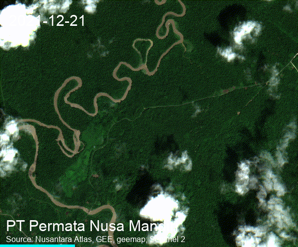
PT Permata Nusa Mandiri (PNM)
During a visit to the site of PNM in January 2022, Mongabay journalists observed unusual activity with cars, heavy equipment and workers. The district government sent a letter to PNM on Feb. 23, ordering PNM to halt its activities on the ground. However, clearing within PNM’s concession continued well after Feb. 23.
Sentinel-2 satellite imagery estimates 117 hectares of forest have been cleared from Dec. 21 2021, to Mar. 11 2022, including 60.5 ha after Feb. 20 2022.
 VIEW IN ATLAS
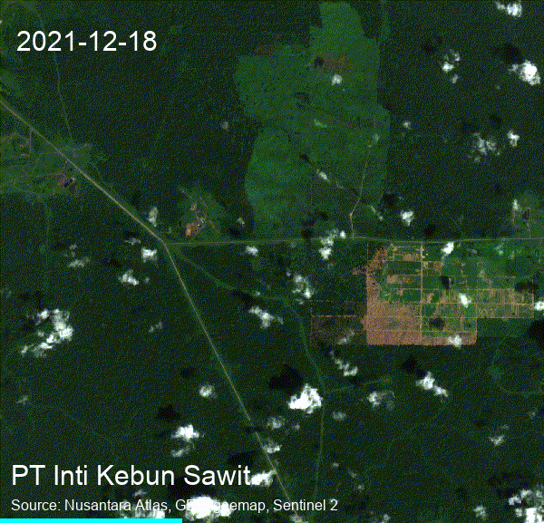
PT Inti Kebun Sawit
Sentinel-2 satellite imagery estimates this company cleared 205 hectares, including 181 hectares of forest from January. 27 2022 to Mar. 13 2022.
 VIEW IN ATLAS
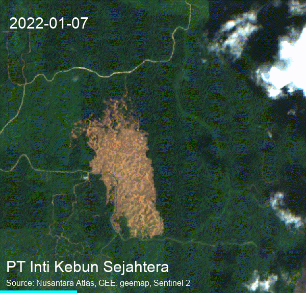
PT Inti Kebun Sejahtera
Sentinel-2 satellite imagery estimates this company cleared 54 hectares, including 48 hectares of forest from Jan. 07 2022 to Apr. 17 2022.
 VIEW IN ATLAS
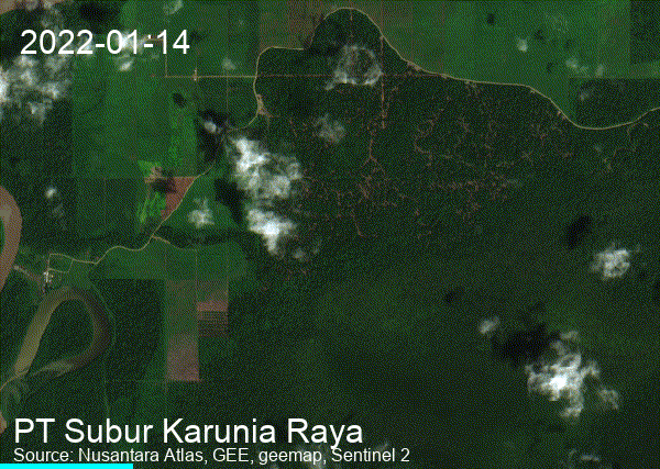
PT Subur Karunia Raya
Sentinel-2 satellite imagery estimates this company cleared 42 hectares of forest from Dec. 21 2021, to Jan. 14 2022, to Mar. 15 2022.
 VIEW IN ATLAS
With diminishing available land elsewhere in the country, plantation companies (oil palm and pulpwood)
are increasingly investing in the development of plantations in Papua and West Papua provinces, while the Indonesian government has invested in ambitious road construction programs to facilitate land
development.
Eighty-three per cent of Tanah Papua remained forest in 2019. This area represents 42% of Indonesia’s forests and is the Asia Pacific region’s largest area of intact old-growth forest.
TheTreeMap endeavors to protect tropical forests through scientific research and advanced monitoring platforms. We are cartographers, remote sensing engineers, software developers, and field investigators. We empower civil society with the tools to detect deforestation in real-time and ensure what happens on the ground is fair, transparent, and democratic. We build systems that check the deforestation footprint of agribusinesses in tropical forests to ensure sustainable production. Our work is based on the premise that no one wants food and other products to be the cause of forest destruction.