 default
 Illegal Deforestation Exposed in Indonesia’s Prime Biodiversity Hotspot.
 default
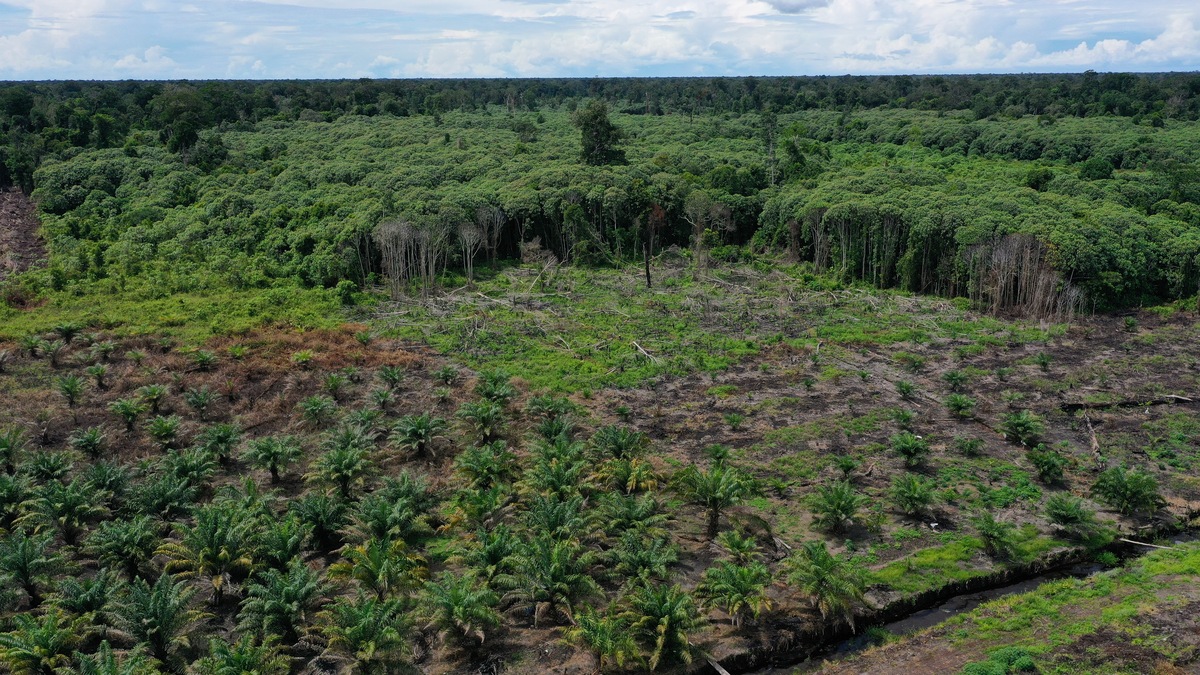
 Rainforest Action Network (RAN) and The TreeMap have released unprecedented satellite evidence of widespread, palm oil-driven deforestation in Indonesia’s Rawa Singkil Wildlife Reserve.
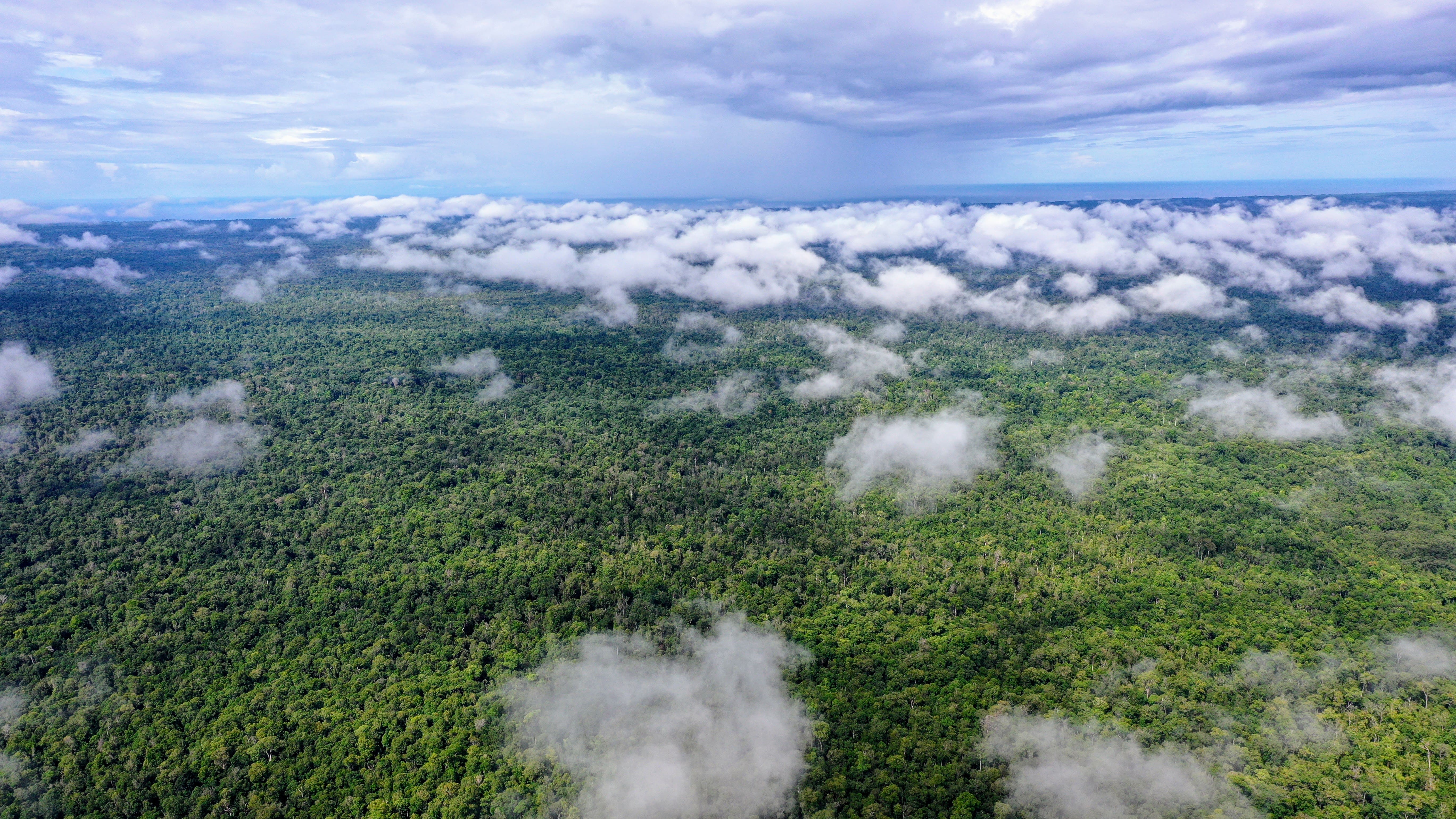
This reserve protects Western Sumatra’s last pristine lowland coastal peat-swamp forests, home to the highest concentration of Sumatran orangutans, around 1,500 individuals, or 10% of the total population.
RAN and The TreeMap tasked Pléiades Neo satellites from Airbus to capture ultra high-resolution (30 cm) images over Rawa Singkil from June to September 2024. These recent data, combined with very-high-resolution (80 cm) imagery from June 2016 captured by TripleSat, 21 AT, and with high-resolution (5 m) imagery from December 2020 captured by Planet/NICFI provide an unprecedented ability to measure the extent of recent deforestation and track the scale of illegal palm oil plantations now operating within the reserve.
This ultra-high-resolution imagery is accessible for interactive viewing on desktop, laptop, and mobile devices via the Nusantara Atlas. The images are also embedded in this article, allowing anyone to zoom in up to a 1:1000 scale, view the official Rawa Singkil boundary (green line), and use a time slider to compare forest cover losses between June 2016 and July/September 2024.
“For the first time, timely satellite images — detailed enough to capture individual palm trees, even young saplings — reveal the full scale of the ongoing palm oil crisis within this unique wildlife reserve. These images enable anyone to document violations that public satellite data previously overlooked, bringing unprecedented clarity and transparency to the situation” stated Dr. David Gaveau of The TreeMap.
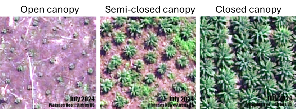
The Airbus imagery reveals oil palm plantations in three stages of development: closed-canopy, semi-closed canopy, and open-canopy. Planted in a 9-meter triangular pattern, young palms in the open-canopy stage measure 0.5-3 meters in diameter, leaving much ground visible. They are under 3 years old and not yet producing any fruit. In the closed-canopy stage, mature palms reach 7-10 meters, with overlapping fronds creating a dense, star-like canopy. The palm trees are at least 4 years old and are currently in production. Semi-closed canopy plantations represent a transitional stage, with about 3-year-old trees around 4-6 meters in diameter, partially closing gaps and beginning to produce.

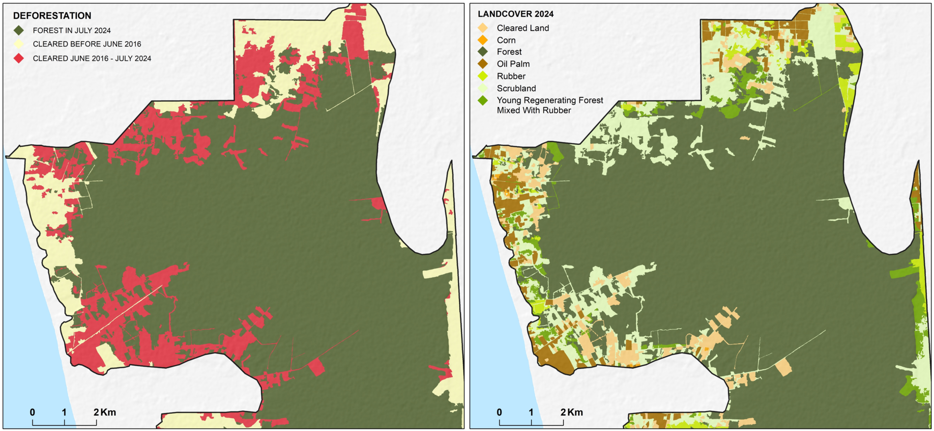
The TreeMap’s analysis reveals that 2,577 hectares of forest have been cleared since June 2016, with 1,915 hectares lost after the EU’s 31 Dec. 2020 deforestation deadline. In total, 652 hectares of active palm oil plantations, including 453 hectares currently producing, exist within this protected reserve — a sign that illegal palm oil is already circulating in major global supply chains.

“The devastation in one of the world’s last pristine ecosystems is a wake-up call for global brands, banks, and consumers,” said Gemma Tillack, Forest Policy Director at RAN. “Our data shows that illegal palm oil is seeping into international supply chains, threatening iconic species like the critically endangered Sumatran orangutan.”
RAN’s field investigations have shown that popular products like Olay, Milo, Oreo’s, Lay’s, and CupNoodles are being made with illegal palm oil. “We have the receipts to prove it,” Tillack said.
Major brands implicated include Procter & Gamble, Nestlé, Mondelēz, PepsiCo, and Nissin Foods, alongside banks such as MUFG, Rabobank, and HSBC. Other banks exposed to further high-risk traders in the region include Singapore’s DBS, UOB, and OCBC; French Bank BNP Paribas; and Malaysian banks Maybank and CIMB.
These entities risk exposure through their sourcing from or financing of traders Royal Golden Eagle Group (Apical), Musim Mas Group, and Permata Hijau Group caught sourcing illegal palm oil.
RAN’s investigation also documents the rise of a new palm oil ‘laundering’ loophole in which wealthy land speculators use the cover of smallholder farmers to avoid accountability for illegal deforestation.
Established in 1998, Rawa Singkil Wildlife Reserve is a globally recognized biodiversity hotspot within Aceh’s Leuser Ecosystem, spanning around 82,000 hectares.
Rawa Singkil’s peat swamps are also crucial for climate stability. These peatlands store vast amounts of carbon deep underground. Clearing and draining Rawa Singkil’s swamps risk releasing all the stored carbon into the atmosphere, and turning the region into another fire hotspot, with severe consequences for the health of local communities.
It is imperative that history does not repeat itself and that Rawa Singkil remains safeguarded. Although the rate of deforestation saw a remarkable increase in recent years, it is still contained to some extent, and with around 78,000 hectares of primary forest remaining, there is reason for optimism.
RAN and The TreeMap urge immediate collaborative action among brands, traders, and financial institutions to invest in sustainable solutions that protect the Singkil-Bengkung Trumon region. A shared vision must prioritize the conservation of lowland rainforests and peatlands while fostering community-led agriculture that respects the rights and livelihoods of local populations.
For comprehensive insights into the Rainforest Action Network’s (RAN) recent findings, explore their dedicated watchdog platform, Forest Frontlines.
