Sumatran orangutans on the Brink: Palm Oil Deforestation Breaks Records in key Protected Area
While palm oil-driven deforestation in Indonesia slowed to a 20-year low in 2021 and stabilised in 2022, a critical protected area suffered unprecedented destruction in Aceh Province, Sumatra.
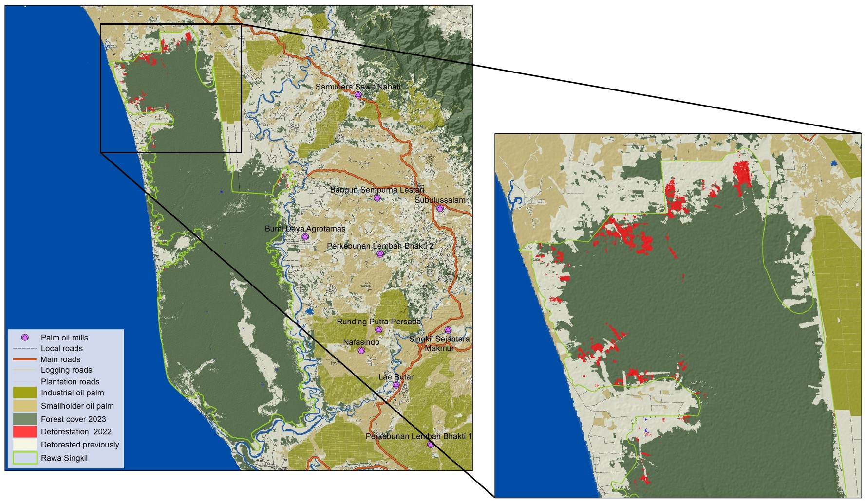
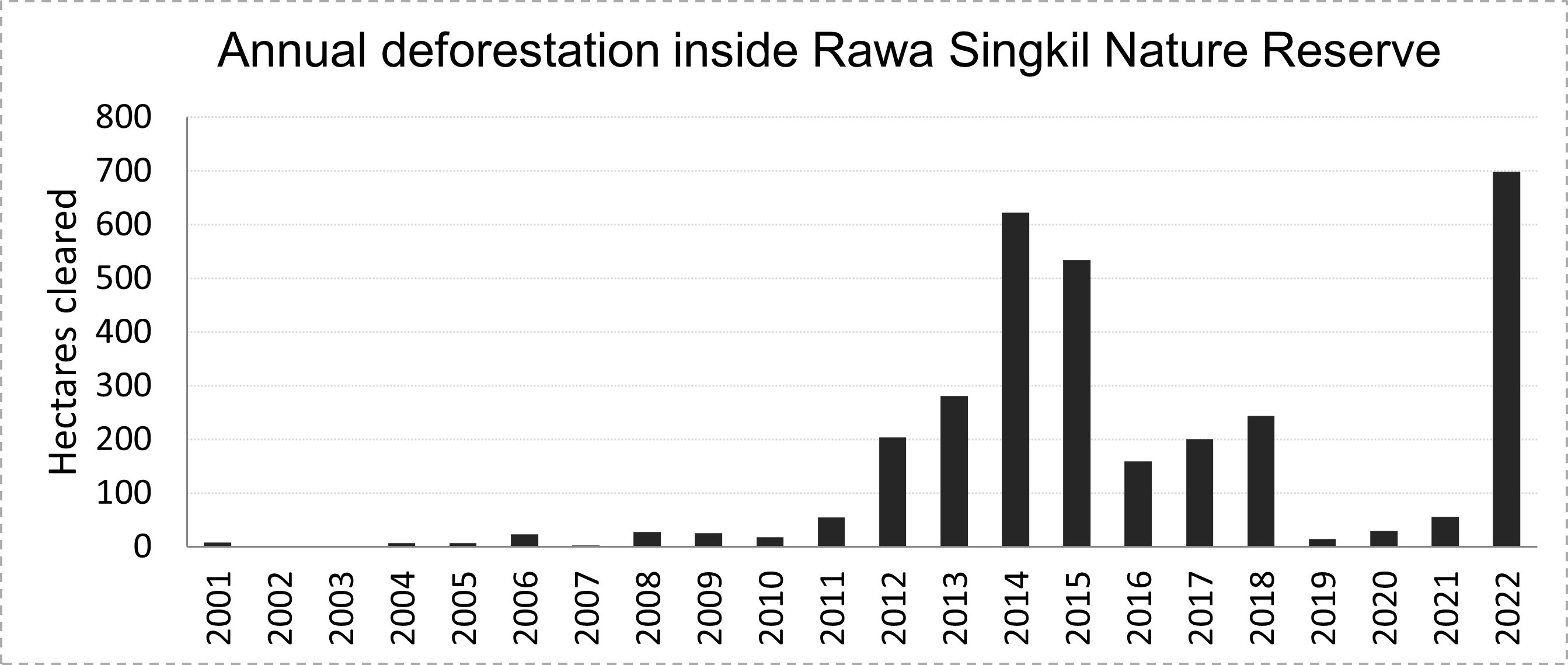
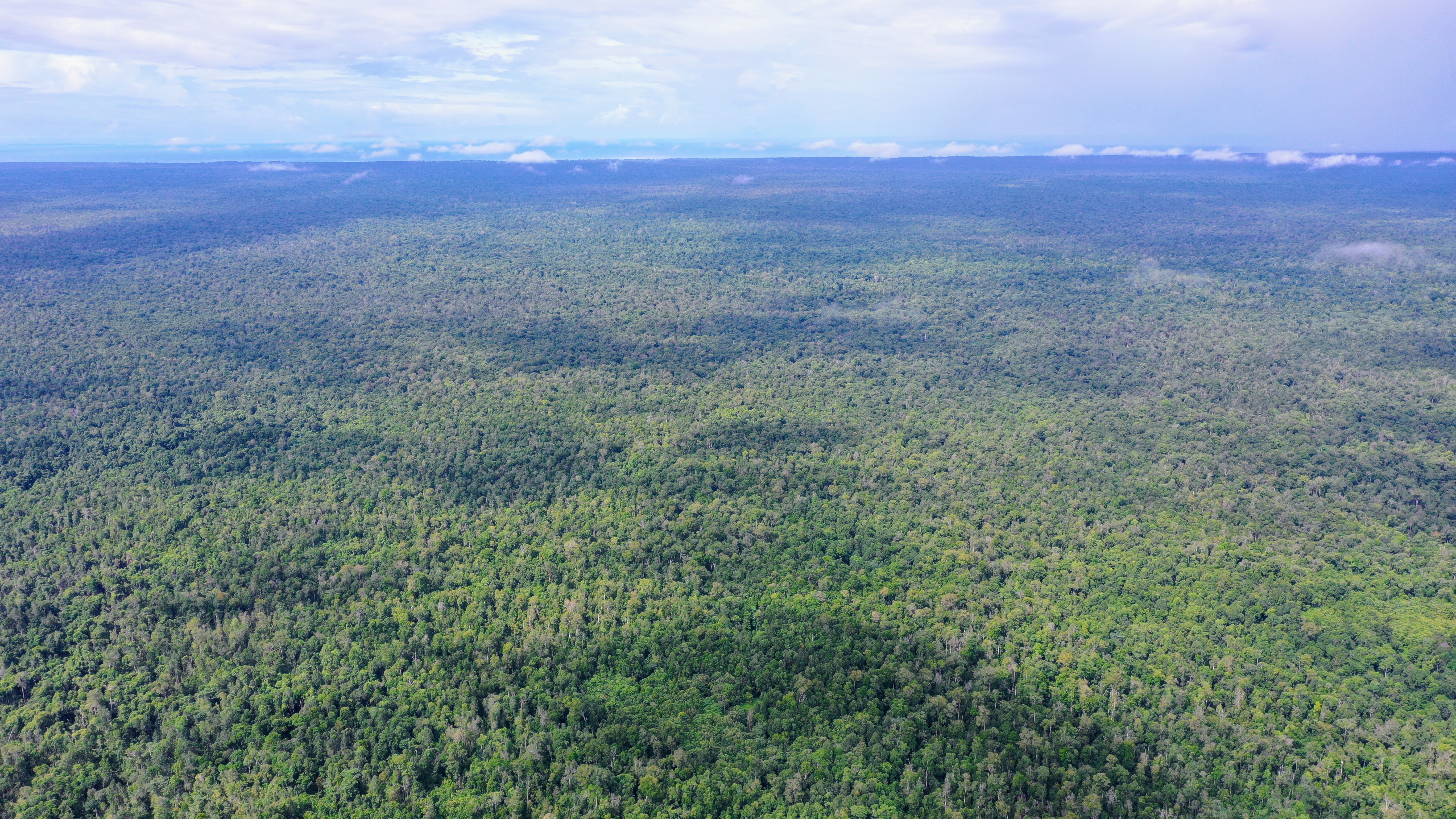
A study conducted by TheTreeMap, utilizing satellite imagery from Sentinel-2 and Planet/NICFI, shows that the Rawa Singkil Wildlife Reserve suffered a record loss of 700 hectares of primary peat-swamp forest in 2022, a twelve-fold increase from the previous year and the highest level of deforestation since 2001.
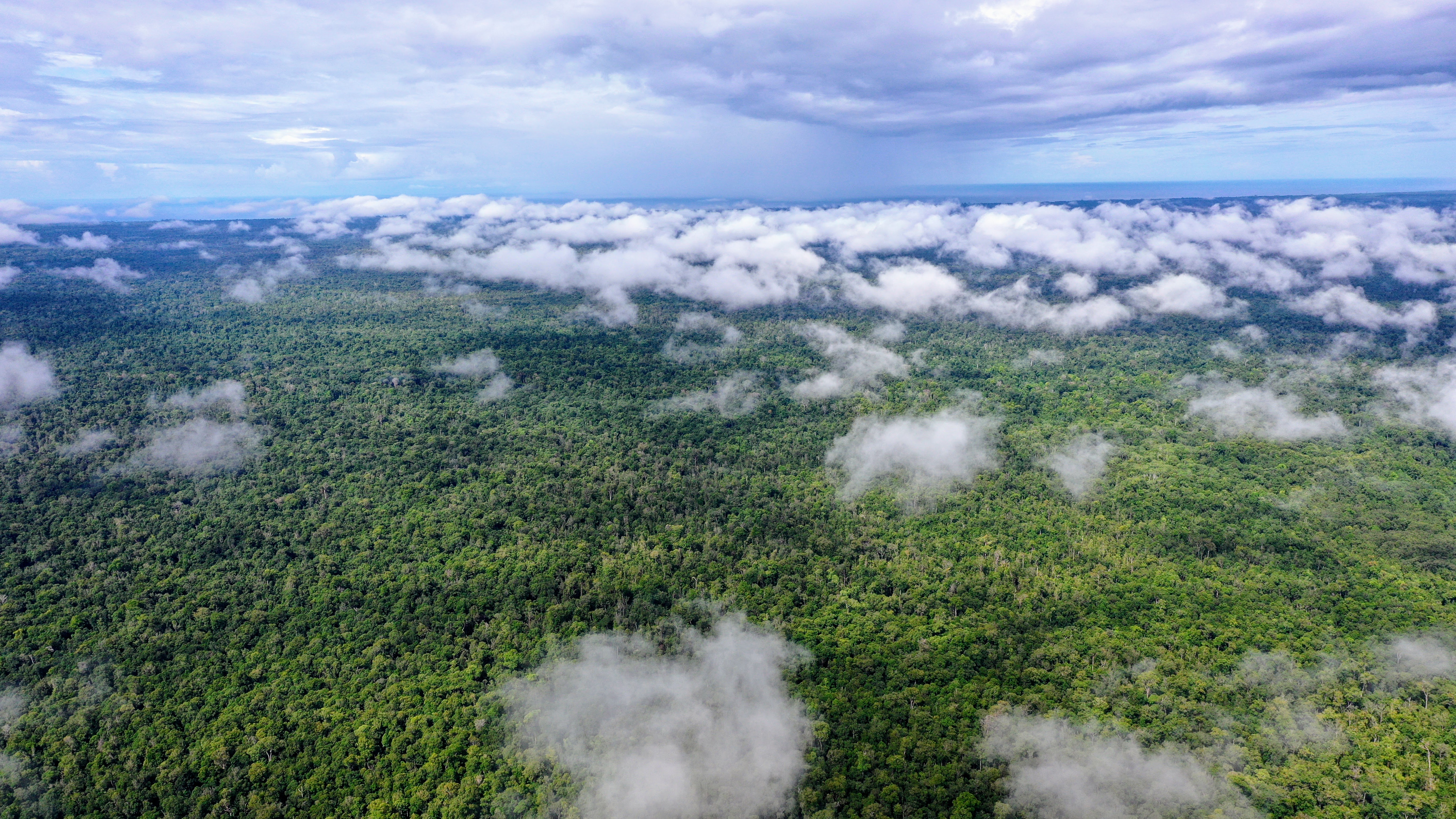
Established in 1998, Rawa Singkil is a globally recognized hotbed of biological diversity, occupying 82,000 hectares in the southwestern region of Leuser. The region is referred to as the “orangutan capital of the world” due to its high concentration of orangutan populations, with 1500 individuals, or 10% of the total population of Sumatran orangutans. It is also the habitat of other endangered species such as Sumatran elephant, and tiger populations.
However, the exact boundary of the Singkil Wildlife Reserve has yet to be clearly defined and marked on the ground, leading to conflicting community claims over land ownership and usage rights in the area. This uncertainty has generated persistent disagreements and tensions between local communities and Indonesia’s conservation agency.
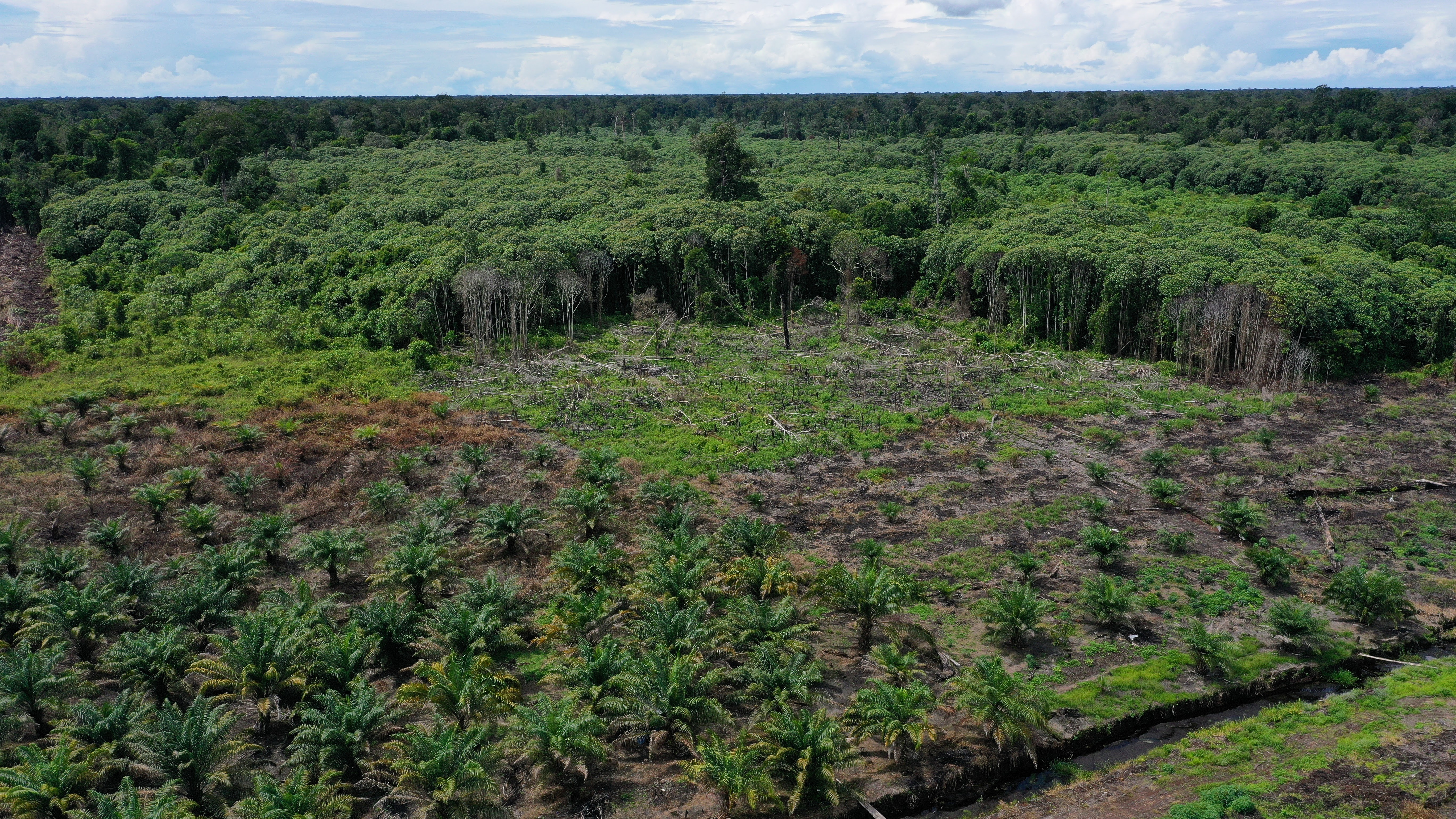
The Rainforest Action Network recently conducted field investigations and documented the presence of illegal palm oil plantations and their operators within the boundaries of the Reserve.
After initially denying the evidence, Three of the world’s biggest palm oil traders –– Musim Mas, Wilmar, and GAR –– have confirmed that some of their indirect suppliers, local businessmen, had established illegal plantations within Rawa Singkil Wildlife Reserve in 2022.
There are twelve mills operating in close proximity to the reserve. All of these mills supply international buyers with Palm oil. The RAN investigation highlights that the traders and buyers are not taking adequate measures to ensure that their suppliers are not obtaining palm oil from growers who are destroying this nationally protected area.
The Rawa Singkil Wildlife Reserve is also of paramount importance to the climate as it encompasses ancient peatlands that are rich in carbon. These peatlands serve as vast storage units for greenhouse gases, holding significant amounts of these potent pollutants within their deep depths.
Deforestation and draining in the reserve would not only have disastrous consequences for wildlife but also have a major impact on the Earth’s climate.
Years of conversion and draining of peat-swamp forests for palm oil and pulp & paper production in Indonesia have transformed vast areas of these carbon sink ecosystems into fire-prone wastelands that pose a significant threat to the climate. The destruction of these peatlands has released massive amounts of greenhouse gases into the atmosphere, contributing to the global climate crisis. The continued degradation of peat-swamp forests in the country is a major concern for the planet’s health.
It is imperative that history does not repeat itself and that Rawa Singkil remains safeguarded. Although the rate of deforestation saw a remarkable increase in 2022, it is still contained to some extent, and with 78,000 hectares of forest remaining, there is reason for optimism.
Immediate action must be taken now to halt the current surge in deforestation before it reaches a point of no return.
TheTreeMap endeavours to protect tropical forests through scientific research and advanced monitoring platforms. We are cartographers, remote sensing engineers, software developers, and field investigators. We empower civil society with the tools to detect deforestation in real-time and ensure what happens on the ground is fair, transparent, and democratic. We build systems that check the deforestation footprint of agribusinesses in tropical forests to ensure sustainable production. Our work is based on the premise that no one wants food and other products to be the cause of forest destruction.