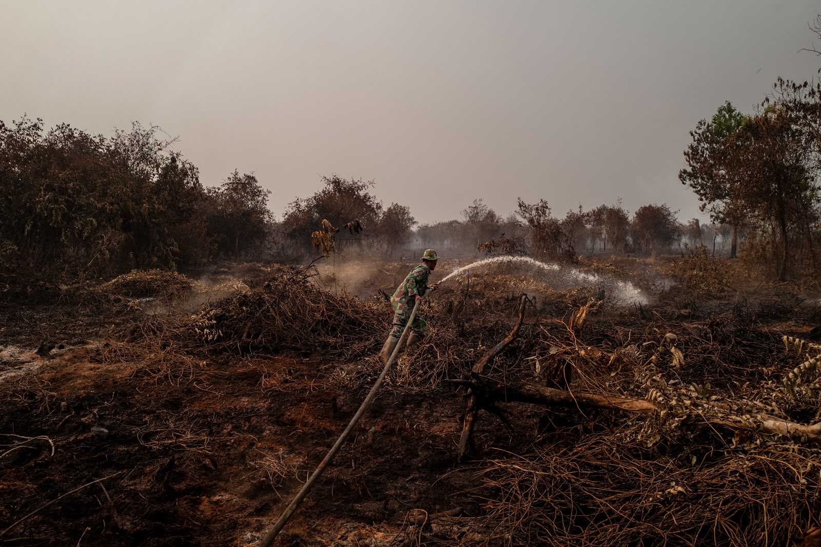
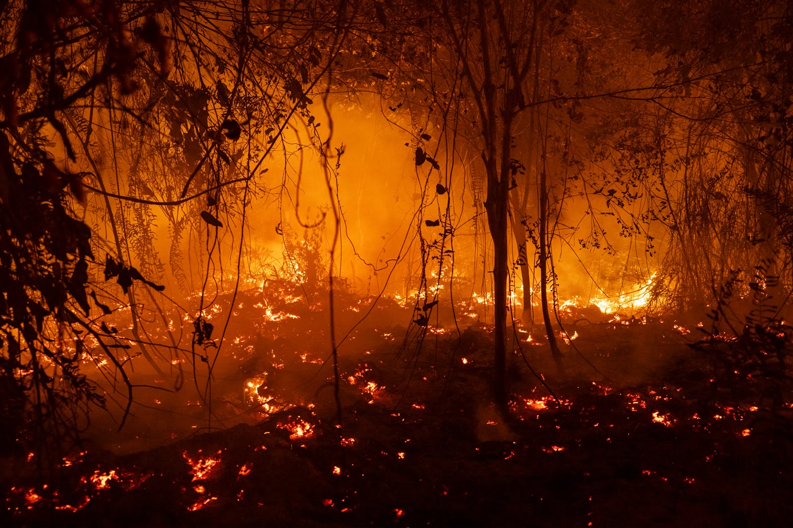
 Fire burning in a location in West Kalimantan, September 2026. Photo by Ulet Ifansasti
Indonesia’s 2026 fires: 1.9 million hectares affected by fire through September
Fire burning in a location in West Kalimantan, September 2026. Photo by Ulet Ifansasti New satellite data documents a sharp increase in burning during September, with 85,000–88,000 hectares of natural forest affected.
Around 1.9 million hectares (Mha) of land were affected by fire across Indonesia between January and September 2026, according to our independent assessment using Sentinel-2 satellite imagery and a method we published in Plos One earlier this year. Over half of the mapped area was detected in September. Within these areas, fire impacts vary: some vegetation may remain unburned, survive or recover. Therefore the numbers presented here describe land affected by fire, rather than an equivalent area of vegetation destroyed.
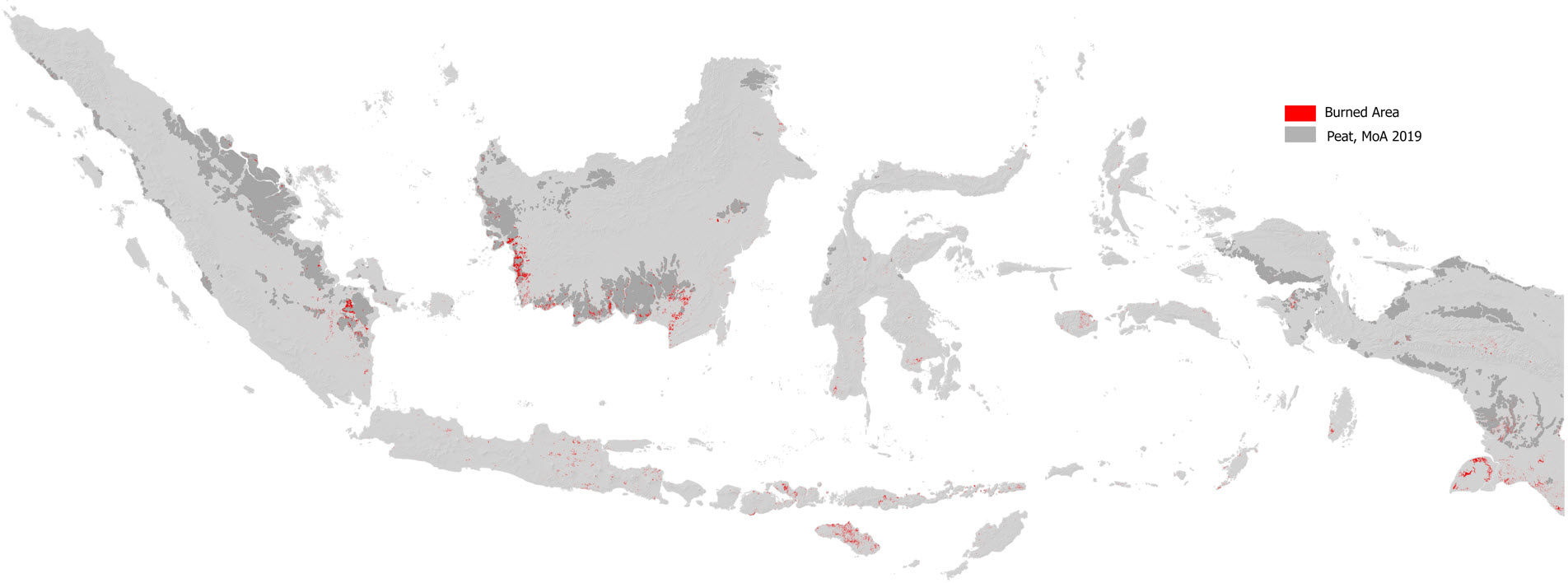
The January–September estimate is 38% higher than during the same period in 2019, the worst fire year in the Nusantara Atlas monitoring record. By 18 October, cumulative satellite hotspot detections were also 67% higher than during the same period in 2019. This comparison uses the same satellites in both years, avoiding an artificial increase caused by adding sensors. A separate comparison using a consistent set of satellites available since 2015 shows that hotspot detections in 2026 remained 33% below the corresponding period in 2015. Nusantara Atlas does not have comparable burned-area estimates for 2015.
Hotspots and burned area measure different aspects of the fire season. Hotspots indicate active fire detections. Burn scars show the land affected (measured in hectares).
Download the January–September 2026 burned area factsheet → [PDF link]
The national total encompasses several vegetation types. Based on Ministry of Forestry’s land cover map, swamp vegetation accounted for 35% of mapped burned area, agricultural land for 20%, and savanna and grassland for another 20%. Natural forest represented a smaller share, around 4.5%.
Two separate land-cover before-fire baselines produced comparable estimates of forest affected by fire. About 88,000 hectares of natural forest were affected by fire based on the Indonesian Ministry of Forestry’s forest classification. Nusantara Atlas’s own forest baseline identified 85,000 hectares.
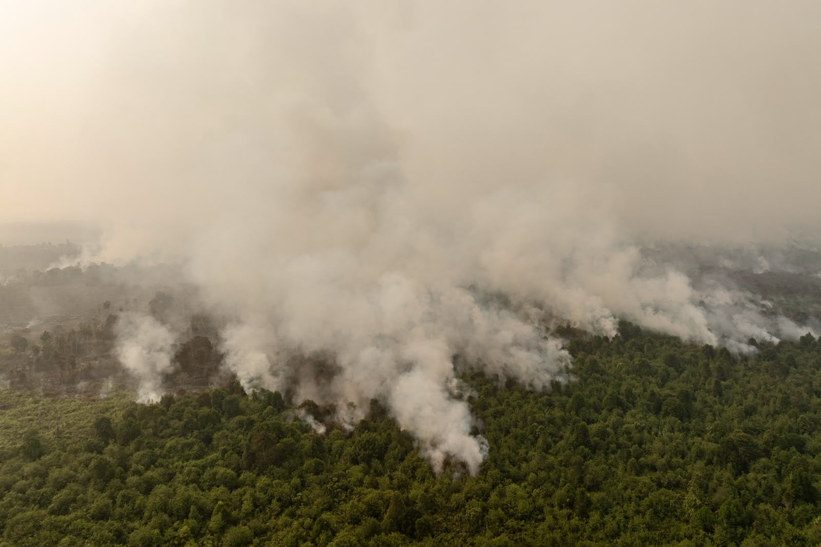
Under the Ministry’s classification, approximately 91% of the affected natural forest was secondary swamp or secondary dryland forest. These are forests that had experienced previous disturbance but retained good forest cover.
Our data indicates that much of the forest affected occurred in September in Ketapang regency along forest edges. However, observations from Gunung Palung National Park in West Kalimantan also reveal burning within the forest interior.
September imagery shows burned patches in the central-eastern part of the park, well inside its forested area. Forest ecologist Prof Douglas Sheil from Wageningen University describes burning in the forest interiors as very rare under natural conditions. These patches do not necessarily indicate that the forest burned uniformly or that all trees were killed: some trees may have survived, and affected vegetation may recover.
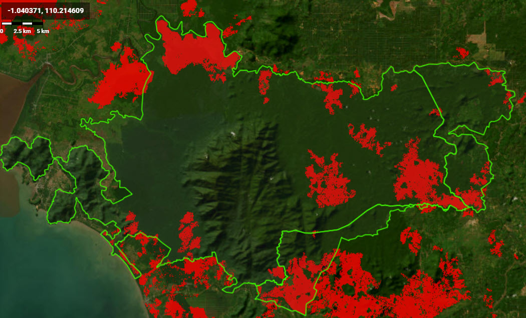
Conversely, Sheil explains that smouldering in forest humus can damage roots and weaken already stressed trees, increasing their vulnerability to insects and fungi and potentially contributing to delayed mortality. Repeat satellite observations and field assessments are needed to determine the extent of damage and subsequent recovery.
Peatland overlap provides another perspective on the national figures. Between 17% and 23% of the mapped burned area fell within official peatland boundaries, depending on whether the 2011 or 2019 Ministry of Agriculture peat map was used.
This is distinct from the finding that 35% of burning occurred in swamp vegetation. Swamp vegetation includes wetlands on various soil types, so that percentage cannot be treated as an estimate of peatland burning. Similarly, a burn scar overlapping a peat map does not, by itself, establish whether the peat soil burned.
The Nusantara Atlas land-cover overlay also recorded 59,200 hectares burned in planted oil palm and 16,300 hectares in planted industrial Acacia. These estimates describe planted land affected by fire. They differ from estimates based on concession boundaries, which can encompass plantations, remaining forest, wetlands and other land covers.
Burning was geographically concentrated. Kalimantan accounted for approximately 684,000 hectares, or 36% of the national total. The ten provinces with the largest mapped burned areas accounted for 86%.
Papua Selatan ranked first among provinces, with approximately 319,000 hectares, followed by Kalimantan Barat with 275,000 hectares, Nusa Tenggara Timur with 223,000 hectares, and Kalimantan Tengah with 220,000 hectares.
These rankings describe the area affected by fire, rather than a uniform measure of ecological impact. Parts of southern Papua and Nusa Tenggara contain savannas, grasslands and seasonal woodlands where fire is recurrent. Burning in those landscapes needs to be distinguished from burning in degraded peatlands and humid forests in West Kalimantan, Central Kalimantan and South Sumatra.
The distinction also matters within individual regencies and protected areas. Merauke recorded the largest mapped burned area (252,627 ha) among regencies, while Pulau Dolok Wildlife Reserve, in Merauke, ranked highest among protected areas (51,639 ha). Traditional burning has long shaped the savanna landscapes of Merauke (also in Sumba and other regions with a marked dry season).
Fire in seasonally dry landscapes is generally of less ecological concern than burning in humid forests and degraded peatlands. Areas warranting particular attention include Ketapang regency (194,000 ha affected), Ogan Komering Ilir (74,000 ha) and Kayong Utara (49,000 ha), including burning within Gunung Palung’s humid forests and on Padang Sugihan’s degraded peatlands in South Sumatra. Regencies in central Kalimantan, such as Pulang Pisau and Seruyan are also of concern.
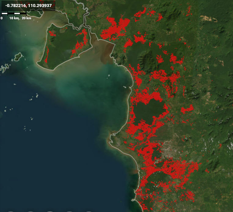
Industrial concession boundaries overlapped substantial areas of burning. Approximately 202,000 hectares were recorded within oil palm concessions, or 10.6% of Indonesia’s total burned area. Mining concessions had 162,500 hectares, or 8.5%, while pulpwood concessions recorded 118,000 hectares, or 6.1%. These land use categories may overlap and should not be added without first removing any shared areas.
The September results show both the scale of Indonesia’s 2026 current fire season and the importance of examining what lies beneath the national number.
Nusantara Atlas maps burn scars using Sentinel-2 imagery and validates candidate burned areas using NASA FIRMS active hotspots from five satellites. The estimates exclude burned patches smaller than 6.25 hectares and favour conservative identification to reduce false detections. The data are processed in Google Earth Engine. The full methodology and data validation are described in our scientific publication published in Plos One.
We note that persistent cloud and smoke can delay detection, meaning some areas may be mapped in a later month than the fire occurred. The figures presented here will be revised as additional imagery becomes available. The next monthly update for October will be available on Nusantara Atlas around November 10.
Download the factsheet, including maps, land-cover breakdowns and geographic rankings → [PDF link]